New Geospatial AI Foundation Models Unveiled by Google Research
Understanding Geospatial Reasoning: Insights about Our Planet
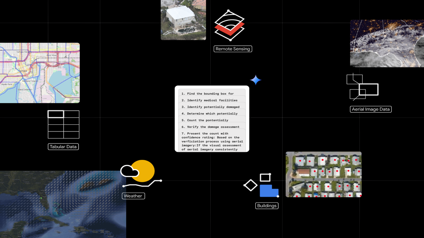
What is Geospatial Reasoning?
Geospatial Reasoning is a cutting-edge research initiative recently unveiled by Google Research. It aims to leverage advanced artificial intelligence to provide in-depth insights into various aspects of our environment. From assessing the effects of natural disasters like hurricanes to identifying optimal locations for city infrastructure, this innovative approach allows users to gain a clearer understanding of geographical data simply by asking relevant questions.
The Role of AI in Geospatial Analysis
Google has developed state-of-the-art geospatial AI models that analyze satellite and aerial imagery. These models are trained using extensive datasets, enabling them to interpret complex images that may be difficult for humans to analyze. This capability allows the AI to identify and report on various features such as:
- Building Changes: Monitoring how structures evolve over time.
- Road Accessibility: Recognizing impassable roads due to natural events or construction.
- Environmental Impact: Evaluating changes in land use and vegetation.
By employing these models, Google Research provides users with comprehensive answers framed in natural language, making the information more accessible and understandable.
Integration with Gemini 2.5
One of the standout features of Geospatial Reasoning is its integration with the Gemini 2.5 platform. This powerful collaboration enhances the AI’s ability to understand and respond to natural language queries. Users can ask questions about anything from local infrastructure developments to environmental changes, and the system will intelligently synthesize information from a variety of geospatial data sources.
The data sources utilized in this process include:
- Maps: Traditional geographical representations.
- Socioeconomic Data: Information about the population, income levels, and other demographics.
- Satellite Imagery: High-resolution images from space that provide a comprehensive view of the Earth’s surface.
- Proprietary Datasets: User-specific data tailored to individual needs or particular areas of interest.
By using these diverse sources, Geospatial Reasoning ensures that users receive well-rounded and contextually relevant insights.
Benefits of Geospatial Reasoning
The introduction of Geospatial Reasoning brings a host of benefits for various sectors:
Urban Planning: City planners can efficiently assess infrastructure needs and environmental impacts, improving community development efforts.
Disaster Response: Emergency responders can quickly gather crucial data about affected regions, enabling faster and more effective assistance.
Environmental Monitoring: Scientists and researchers can track changes in ecosystems and habitats, supporting conservation efforts.
- Business Intelligence: Companies can analyze market trends and competitor locations, helping them make more informed strategic decisions.
How to Learn More
If you are curious to learn more about Geospatial Reasoning and the underlying foundation models, you can visit the Google Research blog. Additionally, those interested in trying out these new models can express their interest by joining the trusted tester program through this link.
With advancements in geospatial AI, the way we analyze and interpret our world is set to evolve dramatically, unlocking new possibilities for understanding the complexities of our environment.