Developing FireSat: An Early Wildfire Mitigation System by Google Research and Collaborators
Overcoming Challenges in Fire Detection
The Complexities of Identifying Real Fires
Detecting actual fires amidst various environmental distractions has posed significant challenges for researchers. Chris, a project member, highlights the difficulty in distinguishing between genuine fire activity and false signals caused by sensor malfunctions or misaligned pixels. The key to solving this problem lay in extensive testing and adjustments.
To refine their technology, the team undertook ambitious testing, even utilizing a plane equipped with sensors. Erica Brand, one of the project managers for FireSat, recalls an early experiment involving a backyard barbeque and fire pit. They used this setup to test how well the plane’s sensors could pick up heat and smoke signatures from these fires. Their efforts proved successful when the sensors detected the barbeque smoke during a flight.
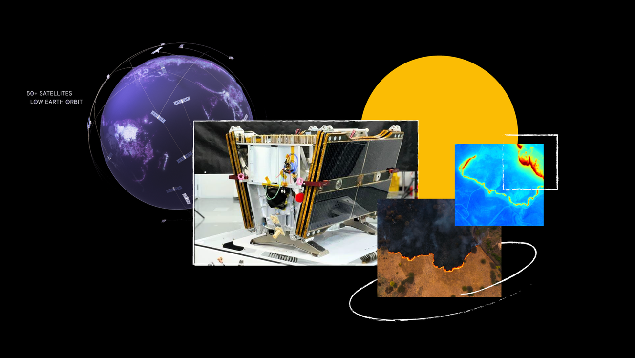
Preparing for Launch
As the project evolved, anticipation built around the launch of the first FireSat satellite. By the time of the interviews, the satellite had just reached the SpaceX launch site. In an effort to witness this historic moment, members of the Google Research team organized a special trip to the launch.
Instead of booking flights, the team decided on a unique travel plan they affectionately called the "minivan caravan." This decision allowed them to bond and experience the excitement together as they awaited the rocket’s ascent to space.
Impact on Firefighting and Climate Science
The launch of FireSat is not just a milestone for the team; it represents a significant advancement in firefighting and emergency response capabilities. With the satellite’s data, firefighters and emergency responders will be better equipped to react swiftly and efficiently when wildfires occur.
Beyond its immediate practical application, FireSat also plays a crucial role in scientific research on wildfires. The satellite’s data will help create a comprehensive historical record of fire spread. This invaluable information will enable scientists to model and comprehend wildfire behavior more effectively.
Juliet, another project member, emphasizes that FireSat serves a dual purpose. While it aids in emergency responses, it is also instrumental in mitigating greenhouse gas emissions. The satellite constellation has the potential to contribute positively to climate change efforts. By monitoring wildfires, FireSat can help reduce the environmental impact associated with these disasters.
The Broader Vision: FireSat’s Goals
FireSat is designed to be more than just an emergency response tool. The overarching vision for the project encompasses long-term benefits for both firefighting efforts and climate science. By improving our understanding of wildfires, the satellite aims to enhance our ability to manage land and protect ecosystems.
With each satellite launch, the team hopes to foster a more profound understanding of fire dynamics. This knowledge can ultimately lead to better wildfire management strategies, reducing the risks posed to communities and natural resources alike.
In summary, FireSat represents a significant advancement in both firefighting technology and climate science. As the satellite begins its journey in space, its potential to enhance emergency response, while simultaneously benefiting scientific research on wildfires and climate change, holds promise for a safer and more sustainable future.